 Gocta Waterfall Tours
Gocta Waterfall Hike Difficulty: What the Trail Is Really Like
Last reviewed August 2026
The Gocta waterfall hike is moderate, long, and harder on your footing than on your lungs: about 5.5 km each way from Cocachimba with roughly 830 m of cumulative climbing, on a clay trail that stays slippery in the shade all year. This page covers the distance, the elevation, the surface and who should not attempt it, and every guided Gocta waterfall tour on this site walks the same route.
Quick answer
The gocta waterfall hike difficulty rating is moderate: about 5.5 km each way from Cocachimba, roughly 10 to 11 km round trip, around 830 m of cumulative ascent, and two to three hours of walking in each direction on a clay trail that stays slippery in the shade year-round. Nobody needs technical skill, but everybody needs four to six hours of walking in their legs and boots with real tread.
Key takeaways
- The trail is well maintained and signposted, so getting lost is close to impossible, but the clay surface is the real obstacle underfoot
- The return leg is harder than the walk in, since the trail undulates through gullies that have to be climbed back out of
- Altitude is not the limiting factor. Chachapoyas sits at 2,235 m but the trail itself runs lower through humid cloud forest
- Horses can be hired in the village for about S/ 40 in cash and cover most of the route, see what to pack for the walk
- The trail is not suitable for wheelchair users or visually impaired travellers, and one operator excludes pregnant travellers as well
- All three Gocta waterfall tours from Chachapoyas use this same Cocachimba route to the base of the lower fall
How Long and How Steep It Really Is
Every figure below comes from the trail itself, not a brochure summary.
The distance and the climb
From Cocachimba to the base of the lower fall is about 5 to 5.5 km each way, which puts the round trip at roughly 10 to 11 km. Cumulative ascent across the day works out to around 830 m, and that figure is cumulative rather than net, because the trail drops and climbs repeatedly rather than gaining height in a single steady line.
Operators schedule two hours out on the assumption of a group that keeps moving without stopping. In practice two and a half to three hours each way is more realistic once you factor in the viewpoints, which most people stop at whether they planned to or not. Budget four to six hours of walking across the full day, not counting the time spent at the fall itself.
| Metric | Value |
|---|---|
| Distance, one way | About 5 to 5.5 km |
| Distance, round trip | Roughly 10 to 11 km |
| Cumulative ascent | About 830 m |
| Walking time, each direction | 2 to 3 hours |
| Surface | Clay, undulating |
| Technical difficulty | None, no scrambling or exposure |
Why the numbers alone don't tell the whole story
A 10 km walk with 830 m of climbing would be an ordinary day on most trail systems. What makes the gocta waterfall hike difficulty conversation different is that the trail does not gain its height in one direction. It undulates into a series of gullies and back out of them, crossing streams on timber and rope bridges along the way, so the total climbing figure hides a lot of short, sharp ups and downs rather than one long grade.
That shape is what catches people who assumed the return trip would be easier simply because it is downhill on paper.
The Trail, Section by Section
A composite of what the walk actually feels like underfoot, stage by stage, based on the route every tour on this site uses.
-
0 to 1 km
Out of the village, through the cane fields
The trail leaves the Cocachimba square on open ground, past sugar-cane plots and old cane mills. Flat and easy, with the fall visible ahead most of the way.
-
1 to 2.5 km
Into the cloud forest
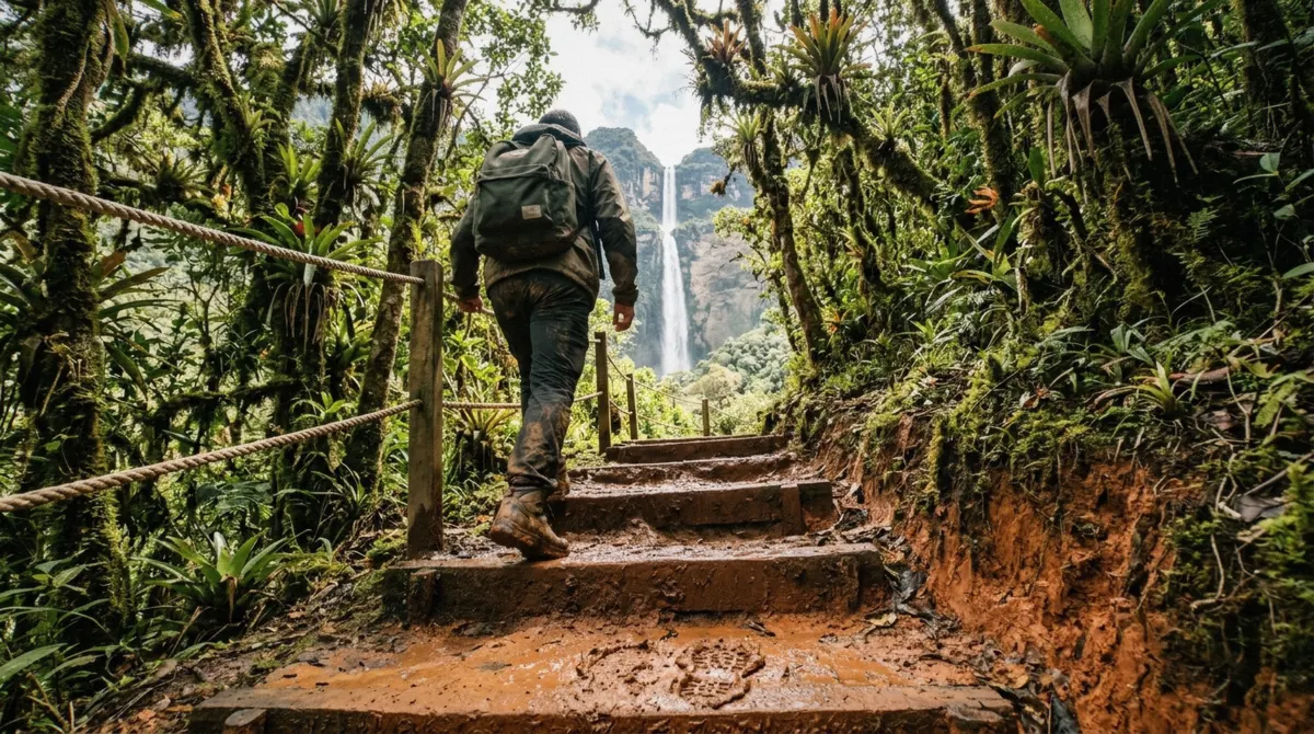
The path narrows and climbs into humid forest hung with orchids and bromeliads. Shade keeps the clay surface damp here even in dry months, and this is where the trail's first real undulation begins.
-
2.5 to 4 km
Gullies and stream crossings
The route drops into a series of gullies, each crossed on timber or rope footbridges, then climbs back out. This section is the true test of gocta waterfall hike difficulty: short, repeated ascents rather than one long climb.
-
4 to 5.5 km
The final approach over the boulders
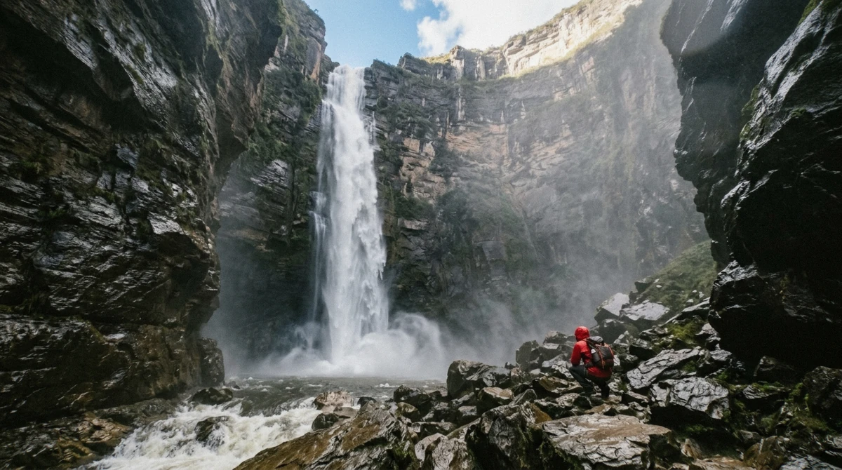
The last stretch to the plunge pool crosses boulders at the base of the 540 m lower tier, where the spray and downdraught off the falling water are strong enough to unbalance a person if you walk upright into it.
-
Return leg
The same route, but harder
Every gully climbed down on the way in has to be climbed back up on the way out, which is why hikers consistently describe the return as the tougher half even though the net elevation change is close to zero.
The Surface, and Why Boots Matter
Clay is the real difficulty here
The trail surface is clay for almost its entire length, and clay behaves very differently from the packed dirt or gravel that most first-time hikers expect. In the December to March rains it turns genuinely greasy, the kind of surface that puts an unprepared walker on the ground within the first kilometre. Even in the drier months from June to September, the shaded sections under the cloud forest canopy stay damp and slick, because tree cover keeps the sun off the ground long after the rain itself has stopped.
Boots with real tread are the single most useful item anyone can bring on this hike, ahead of a rain jacket, ahead of a hiking pole, ahead of anything else on a packing list. Trainers and casual sneakers have essentially no grip on wet clay and turn a moderate walk into a genuinely difficult one within the first gully crossing. Full detail on footwear and everything else worth packing lives on the dedicated packing guide.
Navigation is not the problem
Whatever else challenges a first-time hiker here, finding the way is not it. The path is well maintained and signposted along its entire length, and hikers consistently report that getting lost on the Gocta trail is close to impossible. Every fork is marked, the route follows an obvious single line through the valley, and the community associations in Cocachimba who maintain the trail keep the signage current.
Altitude is also not the limiting factor, despite Chachapoyas itself sitting at 2,235 m. The trail runs lower through humid cloud forest, so hikers arriving from sea level should expect warm, wet air rather than the thin air that catches people out on genuinely high-altitude Andean routes elsewhere in Peru. Duration and footing are what determine gocta waterfall hike difficulty, not elevation.
Is This Hike for You?
If You walk regularly and have no hiking experience at all
This is a reasonable first proper hike. The trail is signposted and technically simple, so the main preparation is footwear and stamina, not skill.
If You have a bad back, a recent injury, or limited mobility
Reconsider. The repeated gully climbs and slick clay put real strain on knees and backs over four to six hours, and there is no shortcut partway through.
If You want the classic photograph but not the full walk
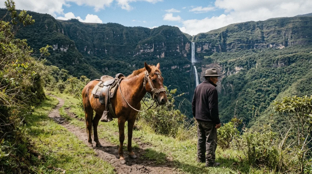
Hiring a horse in the village covers most of the Cocachimba route for about S/ 40 in cash, though the steepest final kilometre still has to be walked.
If You are travelling with young children
Four to six hours of walking on undulating clay is a lot for most children under about ten. Ask the operator about pace before booking a family group.
If You want the quietest version of Gocta
The San Pablo side to the upper fall is a separate, less-walked route; see Cocachimba or San Pablo for how the two compare.
Horses as the Alternative
What a horse actually covers
Horses are hired directly in Cocachimba, in cash, for about S/ 40. They cover the walking sections of the route from the village to the base of the lower fall, which removes most of the physical demand described above. What a horse cannot do is the steep final kilometre linking the two tiers of the fall, which is too steep to ride and has to be walked or skipped regardless of how the rest of the day was covered.
No tour price on this site includes the horse. It is arranged on the spot on the morning of the hike, which means availability depends on what is standing in the village when your group arrives rather than anything bookable in advance. If riding is genuinely your plan and not just a backup, say so when you book the tour so the operator can give the village advance notice. The seven-hour tour from LIMA INCA TRIPS is the only listing on this site that names the option of hiring a horse in its own highlights.
At the Base: Spray, Wind and the Pool
The last stretch is not a casual approach
The final approach to the plunge pool crosses open boulders directly in front of the 540 m lower tier, and the spray and downdraught coming off that much falling water are strong enough to unbalance a person walking upright into it. Most visitors approach the last stretch low, moving over the rocks rather than walking normally, which is standard practice here rather than a sign anything has gone wrong.
There is a deep, cold pool at the base and people do swim in it. Treat it exactly as you would any unlifeguarded mountain water: cold, dark, and worth respecting rather than diving straight into after a warm four-hour hike.
Who Should Not Do It
Pulled directly from the operators' own listings, not a general assumption about the trail.
The stated exclusions
Every operator running this trip states the hike is not suitable for wheelchair users or for visually impaired travellers, and the terrain description above explains why: undulating clay, boulder crossings, and timber footbridges are not passable without full mobility and full vision. The bilingual-guide tour from Journey Peru SAC is the listing that separately excludes pregnant travellers, and the seven-hour LIMA INCA TRIPS tour states the trip is not suitable for anyone over 95. None of the three states a minimum age, but the duration alone rules out very young children on a practical basis.
| Restriction | Why it applies here | Ask before booking if |
|---|---|---|
| Wheelchair users | No paved or wheelchair-accessible sections exist anywhere on the route | You use any mobility aid |
| Visually impaired travellers | Boulder crossings and footbridges need full vision to navigate safely | You have any vision impairment |
| Pregnant travellers | One operator excludes pregnancy explicitly; the terrain and duration are demanding regardless | You are pregnant, at any stage |
| Travellers over 95 | One listing states an upper age exclusion | You or a travelling companion is close to this age |
| Bad backs or recent surgery | Repeated gully climbs on slick clay strain joints over several hours | You have a back condition or recent injury |
What the Walk Back Is Like
Harder than most people expect
The return leg follows the same trail in reverse, and it is consistently the part of the day that surprises first-timers. Every gully the trail dropped into on the way in has to be climbed back out of on the way back, and legs that are already tired from two to three hours of walking and standing at the fall feel every one of those short climbs more than they did on the way out. Add in afternoon sun on the open cane-field sections near the village, and the return often takes as long as the outbound leg even though it covers the same 5 to 5.5 km.
The practical takeaway is to pace the outbound walk with the return in mind rather than treating the fall as the finish line. Most operators build a lunch stop into the schedule after the return to Cocachimba, which is a reasonable point to accept that the hardest physical part of the day is genuinely over. Beyond the trail itself, the next thing worth sorting out before you go is what you carry on your back, covered in full on the Gocta packing guide, and when to schedule the trip in the first place, covered on the best time to visit page.
None of this makes the Gocta hike a hard trek by the standards of serious mountain trails. It is a long, moderate walk on a genuinely tricky surface, doable by anyone in reasonable general health who packs proper footwear and accepts that the return will take real effort. The trail itself has already sorted out who it suits and who it doesn't, through the exclusions the operators list rather than through anything vague.
Gocta Waterfall Hike Difficulty: Questions Travellers Ask
Can beginners hike to Gocta?
Yes. The trail needs no technical skill and is signposted well enough that getting lost is close to impossible. What beginners underestimate is the duration, four to six hours of walking across the day, and the clay surface, which is why boots with real tread matter more here than fitness alone.
Do I need hiking boots for Gocta, or will trainers do?
Boots with genuine tread are strongly recommended. The clay trail is slippery in shaded sections year-round and genuinely greasy from December to March, and trainers have little grip on either. See the full packing list for everything else worth bringing.
How many kilometres is the Gocta trail from Cocachimba?
About 5 to 5.5 km each way, which works out to roughly 10 to 11 km for the round trip to the base of the lower fall and back.
Is the walk to Gocta the same distance as the walk back?
Yes in distance, no in effort. The route undulates through gullies on the way in and those same gullies have to be climbed on the way back, so the return leg consistently feels harder even though the mileage is identical.
What time should I start the Gocta hike to avoid the worst of the heat?
Tours typically leave Chachapoyas by mid-morning, which puts most of the walking in before the hottest part of the afternoon. The open cane-field sections near the start and end of the trail are the most exposed to direct sun.
Does the altitude in Chachapoyas make the hike harder?
Not meaningfully. Chachapoyas sits at 2,235 m, but the Gocta trail itself runs lower through humid cloud forest, so the challenge here comes from duration and footing rather than thin air.