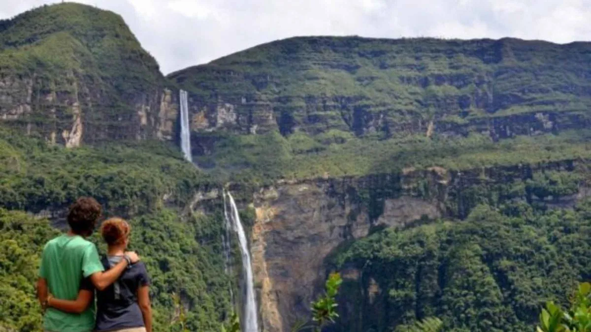
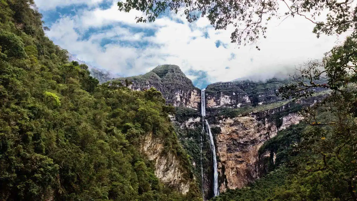
Gocta Waterfall Tours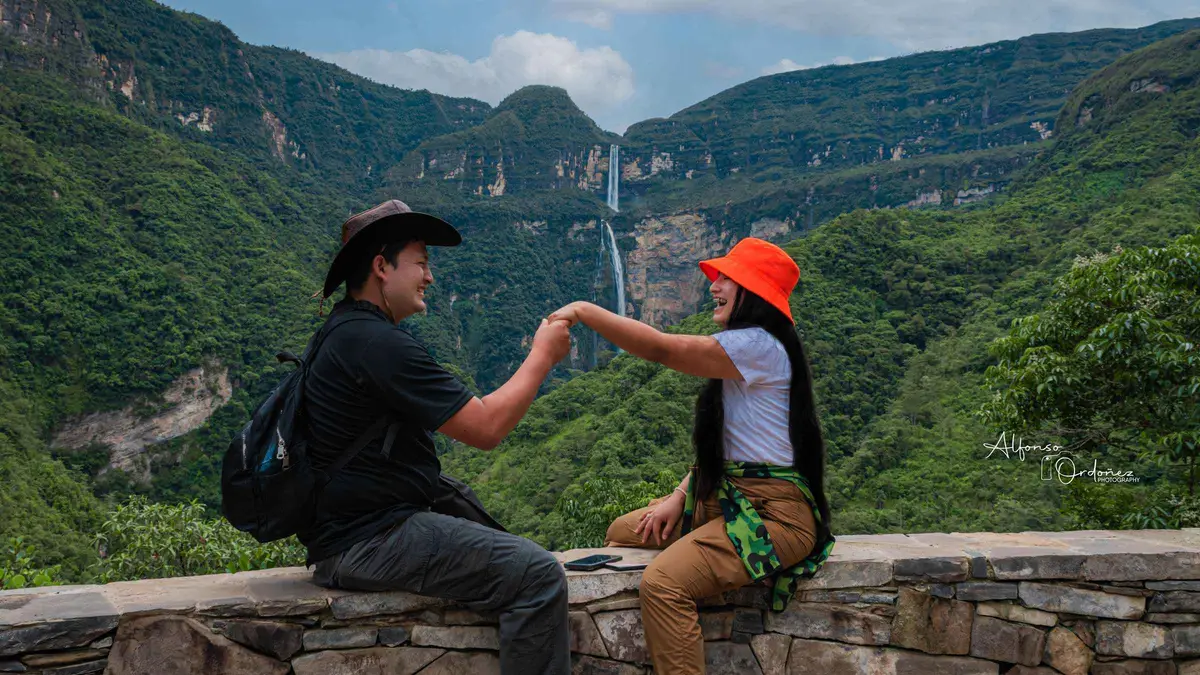
Gocta Waterfall Full-Day Hike from Chachapoyas
The shortest of the three: a 9:30 am start, one hour on the road to Cocachimba, then two hours on foot to the base of the…
- Cancellation
- Free cancellation 24h
- Operator
- LIMA INCA TRIPS
Peru's 771-metre cataract falls in two leaps into cloud forest, 42 km from Chachapoyas and reachable only on foot or horseback. The three Gocta waterfall tours below are compared on what actually separates them: the guide's language, whether lunch is paid for, and how long you stand at the base.
Updated August 2026
Quick answer
We currently compare three guided Gocta waterfall tours running out of Chachapoyas. Every one of them drives to the village of Cocachimba, walks two to three hours to the base of the lower fall and returns the same afternoon, so the day itself barely varies. What varies is the detail: the $44 trip is the cheapest and gives the longest stated time at the fall, but the guide works in Spanish; the $50 trip is the only one that states a bilingual guide; the $47 trip is the shortest day and leaves lunch for you to order and pay for in the village. The entrance ticket is included on all three, and all three are new listings with no reviews yet.
Key takeaways
Three bookable day trips, all leaving Chachapoyas in the morning and returning late afternoon. Prices and inclusions were read directly from the operators' listings in August 2026 and are confirmed at checkout on the booking platform, not here. None of the three carries a traveller rating yet, so the cards below compare what the operators state rather than a score.
The shortest of the three: a 9:30 am start, one hour on the road to Cocachimba, then two hours on foot to the base of the…
The cheapest listing and the longest day: nine hours, two and a half hours of hiking each way, an hour and a half at the fall…
The only listing that states a professional bilingual guide, which is what you are paying the extra $6 for. Pickup at 9:30 am near the Plaza…
The prices sit within $6 of each other, so price is the weakest way to choose. Read the guide-language and lunch columns instead.
| Tour | Price | Total day | Book | Guide language | Lunch | Still to pay in the village | |
|---|---|---|---|---|---|---|---|
| Shortest day | $47 | 7 hours | Details | Spanish and English listed; inclusions say Spanish | Ordered a la carte, you pay | Lunch, about S/ 25–35 | → |
| Lowest price | $44 | 9 hours | Details | Spanish, "little bit English" | Included | Nothing stated | → |
| Bilingual guide | $50 | About 8 hours | Details | Professional bilingual guide | Included | Nothing stated | → |
Three different operators run these: LIMA INCA TRIPS, Turismo iPeru and Journey Peru SAC. Horse hire is extra on every one of them, arranged and paid in cash in Cocachimba.
Dates and live pricing for the bilingual-guide option, straight from the booking platform. The prices quoted on this page were read from the listings in August 2026 and can move.
All three sell the same mountain, the same trail and nearly the same clock. Choose on the three things that genuinely differ.
The bilingual-guide trip run by Journey Peru SAC is the only one of the three whose inclusions state a professional bilingual guide in Spanish and English. That is the whole case for it. Pickup is from hotels near the Plaza de Armas at 9:30 am, the drive to Cocachimba takes about an hour, the hike takes about two hours each way, and you are back in Chachapoyas around 5:30 pm.
Gocta is a walk where the commentary carries the day. The trail passes sugar-cane plots and their old mills, crosses into cloud forest hung with orchids and bromeliads, and opens onto viewpoints where both tiers of the fall line up. A guide who can explain the cock-of-the-rock lek, the mermaid story or why the two tiers are argued over turns three hours of climbing into something. A guide you cannot follow turns it into three hours of climbing.
This listing asks for a WhatsApp number at booking and confirms last-minute dates by email, so book a day or two out rather than the night before.
The $44 trip from Turismo iPeru is the cheapest listing and, on paper, the most generous with time: it states a 9-hour day, 2.5 hours of walking in each direction and an hour and a half at the waterfall itself, which is the longest stated time at the fall of the three. Departure is 9:00 am, lunch in Cocachimba is included, and the vehicle leaves the village at 4:30 pm.
The trade is language. The operator writes that the guide works in Spanish, "a little bit English". If you have some Spanish, or you are content to walk and look, this is the most day for the least money. If you do not, you are paying for transport and a ticket, which you can arrange yourself for less — see tours versus going independently.
The $47 trip from LIMA INCA TRIPS is the shortest at 7 hours: leave at 9:30 am, one hour on the road, a guided section of about three hours, back between 5:30 and 6:00 pm. It is also the only one that names the Andean cock-of-the-rock in its own highlights and the only one that mentions the option of hiring horses.
Read its inclusions carefully. The tour covers hotel pickup, transport, the entrance ticket and a first-aid kit. Lunch is not included: the group stops in Cocachimba on the way in to order from a village restaurant, and you pay for that meal on the way back. Budget roughly S/ 25–35 in cash for a menú. Horse rental, drinks and travel insurance are excluded as well.
None of these listings carries a single review or star rating — all three are new on the platform. There is no traveller score to lean on, and the usual shortcut of sorting by rating simply does not work on this waterfall right now.
That is not a reason to avoid them. It is a reason to buy on stated inclusions rather than reputation, and to use the free-cancellation window as your safety net: all three allow cancellation up to 24 hours before the start for a full refund, and all three let you reserve now and pay later, so a date can be held while your flights into Jaén or Chachapoyas are still moving.
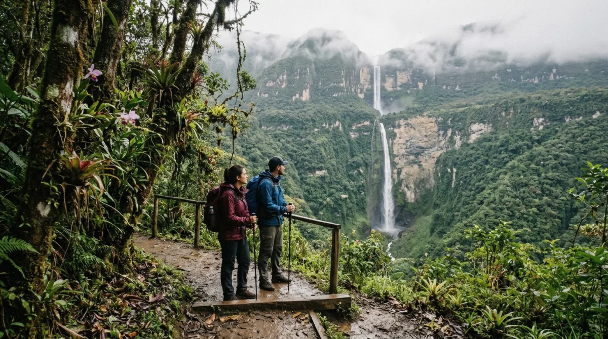
Gocta is not one drop. It falls in two, and the gap between them is what the world-ranking argument is really about.
Waterfall databases that require a single uninterrupted drop rank the two tiers separately, which is why Gocta sits far lower on their lists than on the tour brochures.
Short answer: almost certainly not, and it does not matter as much as the listings think it does.
The German explorer Stefan Ziemendorff reached the falls with Peruvian companions in 2002 and announced a measured height of 771 m at a press conference on 11 March 2006. In the same announcement he placed Gocta third among the world's free-leaping waterfalls, behind Angel Falls and Tugela Falls. That comparison was drawn against incomplete National Geographic figures and has been disputed ever since; the World Waterfall Database, which applies its own consistent criteria, ranks Gocta somewhere around 16th to 18th.
The disagreement is not about the tape measure. Everyone accepts 771 m top to bottom. The argument is whether a fall with a distinct break between a 231 m upper tier and a 540 m lower tier counts as one waterfall or two. Count it as one and Gocta is enormous. Count the tiers separately and the lower drop alone still puts it among the tallest single leaps in South America, just not on the podium.
Tour listings, including two of the three on this page, still print the podium version. It is worth knowing which claim you are being sold before you read the rest of a listing.
It was never lost. Families in Cocachimba and San Pablo had farmed under the fall for generations, and Peruvian maps of the area existed. What did not exist was a published measurement and an international audience.
Local lore explains the silence: a blonde-haired mermaid is said to guard a treasure in the pool at the base, and villagers held that revealing her waterfall would bring a curse down on the community. Whether you take the story as belief or as a way of keeping something valuable to yourself, the practical effect was the same — Gocta stayed off the tourist map until a foreigner published a number.
The Peruvian government moved quickly after the 2006 announcement, and the two access villages built the trails, the ticket office and the small lodges that the visit runs on today. The money you pay at the village office is the mechanism that maintains the path you walk on.
Ranking arguments aside, the reason this trip is worth a day is scale and setting. The lower fall lands in a natural rock amphitheatre; the spray and downdraught at the base are strong enough to knock a person off balance, which is why people crawl the last stretch over the boulders rather than walking upright to the edge.
And the walk in is not a corridor to a viewpoint. It runs through cane fields, then humid cloud forest of orchids, bromeliads and moss, with the fall visible from most of the ridgeline. The Andean cock-of-the-rock, Peru's national bird, lives in this forest, and the wider Amazonas region holds the endangered yellow-tailed woolly monkey and the marvellous spatuletail hummingbird — the reason birding groups come here at all.
Total height, in metres, of the falls that appear in the ranking argument. Gocta is huge by any measure — it is the podium claim, not the size, that is disputed.
Yumbilla, two hours away by road from the same base town, is measured taller than Gocta and sees a fraction of the visitors.
Two villages sit on opposite sides of the valley, and they lead to two different waterfalls — or rather, to two different halves of the same one.
This is the route every tour on this page uses, and the one most people mean by "the Gocta hike". The trail leaves the village square, contours around the valley and drops to the foot of the 540-metre lower tier: about 5 to 5.5 km each way, roughly 10 to 11 km round trip, with something in the order of 830 m of cumulative climbing across the day.
What you get for it is the amphitheatre — standing at the plunge pool, in the wind and spray, looking straight up the wall. It is the most physical version of the visit and the most photographed.
| Route | Distance | Time one way | What you reach | Sold as a day tour? |
|---|---|---|---|---|
| Cocachimba to the lower fall | about 5.5 km | 2 to 3 hours | The plunge pool at the base | Yes — all three tours here |
| San Pablo to the upper fall | about 5.8 km | 1 h 15 to 2 hours | The upper-tier viewpoint | Rarely; arrange locally |
| Full circuit San Pablo to Cocachimba | about 15 km | 5 to 7 hours | Both tiers, one way through | No listing on the platforms sells it |
From San Pablo the walk to the upper-tier viewpoint takes about an hour and a quarter to two hours, climbs more overall, and passes far fewer people. Hikers who do both consistently rate this side the better walk: wilder forest, wider views over the valley, and the fall approached from above rather than below.
The complete circuit — San Pablo up to the upper tier, down the steep 1 km link to the lower tier, then out to Cocachimba — is about 15 km and needs transport waiting at the far end, because you finish in a different village from the one you started in. No day tour on the booking platforms sells this. If you want it, you arrange a driver and a local guide in Chachapoyas directly, or you stay a night in one of the villages and do it independently.
Take Cocachimba if this is your only visit and you want the classic photograph and the feeling of standing under it. Take San Pablo if you have hiked a lot, want the forest more than the plunge pool, and would rather not share the trail.
One practical note that catches people out: the ticket is sold per fall. Around S/ 10 covers one of them; the circuit ticket that takes in both costs around S/ 20. Buying the cheaper ticket in Cocachimba and then deciding to climb to the upper tier is not how the system works.
Moderate, long, and muddier than most people expect. Nobody needs technical skill; everybody needs four to six hours of walking in them.
From Cocachimba: about 5 to 5.5 km each way, 10 to 11 km round trip, roughly 830 m of cumulative ascent, and two to three hours in each direction at an ordinary pace. Operators schedule two hours out on the assumption of a group that keeps moving; two and a half to three is more realistic if you stop at the viewpoints, which you will.
The route is not a steady climb. It undulates hard — down into gullies, across streams on timber and rope bridges, then back up — so the return leg feels heavier than the outbound one even though the elevation nets out. The last section to the plunge pool crosses boulders.
Altitude is not the issue here. Chachapoyas sits at 2,235 m and the trail runs lower, through humid cloud forest. Expect warm, wet air rather than thin air.
The path is clay. In the December to March rains it turns to a slick that will put you on the ground in trainers, and even in the dry months the shaded sections stay greasy. Boots with real tread are the single most useful thing you can bring; walking poles are the second.
The trail itself is well maintained and signposted — hikers consistently report that getting lost is close to impossible — so the challenge is footing and duration, not navigation.
At the base, the wind and spray off a 540-metre column of falling water are genuinely forceful. People approach the pool low, over the rocks, rather than walking upright. Swimming is possible and the water is cold and dark; treat the pool with the same caution as any unlifeguarded mountain water.
Horses are hired in the village for about S/ 40, paid in cash on the spot, and they cover the Cocachimba side to the lower fall and the San Pablo side to the upper fall. The steep kilometre linking the two tiers is not rideable.
No tour price on this page includes the horse. You arrange it in the village on the morning, which also means availability is whatever is standing there when you arrive. If riding is your plan rather than your backup, say so at booking so the operator can warn the village ahead.
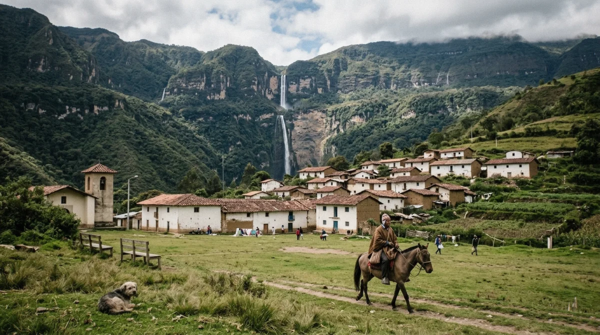
Everything at the trailhead is cash, in soles, in the village. There is no card machine and no online ticket.
The entrance ticket is bought at the visitor office in the village you start from — Cocachimba or San Pablo. It runs about S/ 10 per person for one fall and about S/ 20 for the circuit that takes in both tiers. Visitor reports from 2025 and 2026 quote figures anywhere from S/ 10 to S/ 20 for a single fall, so treat the number as a range that the community office can adjust, not a fixed national fee.
All three tours on this page state the entrance ticket as included, so you are not paying it twice. Carry around S/ 30 in small notes anyway: the ticket if you go independently, lunch on the $47 trip, the horse if you want one, and a drink in the village after.
The ticket revenue stays with the community associations in Cocachimba and San Pablo, which cut and maintain the trail, keep the bridges standing and staff the office. This is the mechanism that turned a waterfall nobody outside the valley had measured into a place you can walk to in an afternoon.
It also explains the price variation. Two villages, two associations, two ticket desks — and prices that move independently of each other and of whatever a blog wrote two years ago.
Getting there yourself is cheap and completely doable. What the $44 to $50 buys is language, a seat and someone else handling the clock.
A colectivo from Chachapoyas heading towards Pedro Ruiz costs about S/ 5, and a tuk-tuk from the highway junction into Cocachimba or San Pablo about S/ 10 each way. Add the entrance ticket and you are under S/ 30 — roughly $8 — for the same waterfall, on the same trail.
Local Chachapoyas agencies sell a Spanish-language group day trip for about S/ 60 to S/ 90, which is $16 to $24. One well-known regional seller lists the day at S/ 90 with shared transport, a Spanish-speaking guide and the entrance fee included, hotel pickup excluded, running 09:00 to 17:00 with a minimum age of 10.
So the platform prices are not the local price. They are the local price plus English, plus hotel pickup, plus a booking you can cancel free 24 hours out from another country.
| How you go | Cost per person | Language | Who handles the clock |
|---|---|---|---|
| Colectivo plus tuk-tuk, walk unguided | under S/ 30 (about $8) | None | You |
| Local agency in Chachapoyas | S/ 60 to S/ 90 ($16 to $24) | Spanish | The agency, once you are in town |
| Platform listing, Spanish guide | $44 | Spanish, little English | Booked before you fly |
| Platform listing, bilingual guide | $50 | Spanish and English | Booked before you fly |
Three cases make the booking worth its premium. First, if you do not speak Spanish: the local desks sell in Spanish, and a trail guide you cannot understand costs you the entire natural-history layer of the day. Second, if your dates are tight — the platform listings can be held with free cancellation and reserve-now-pay-later while flights into Jaén are still unsettled, which no village desk will do for you. Third, if you are arriving in Chachapoyas late the night before and do not want to spend the morning finding a colectivo.
If none of those apply, going independently is a legitimate choice and the trail will not be harder for it. Bring cash, start early, and be walking out of the village by 9:00 am so you are not descending in afternoon rain.
Rainfall decides everything here: how much water comes over the lip, how much cloud hides the upper tier, and how deep the clay is under your boots. Bars are the ten-year average monthly rainfall at Chachapoyas, 2015 to 2024; the figure below each is the average daytime high.
The fall never dries up — it is fed by cloud-forest rainfall year-round, which is why every operator sells the trip in all twelve months.
The numbers above translate into three quite different days out.
March averages 182 mm of rain and is the wettest month of the year in Chachapoyas. Gocta is at its loudest and widest, the spray at the base carries far up the trail, and side streams that are dry in July become small waterfalls of their own along the path.
The price is footing and visibility. Clay turns to grease, the descent back to the village is slow, and low cloud sits in the valley often enough that the upper tier disappears for hours at a time. Go in these months for power, not for photographs of the whole 771 metres.
July averages 18 mm across the whole month — this is as dry as northern Peru's cloud forest gets. The path is firm, the air is clearer, the upper tier is visible far more reliably, and the walk is simply more pleasant.
The fall is visibly thinner than in March, but it is never a trickle: this is a perennial waterfall fed by Andean rainfall, and the 540-metre lower drop does not stop being enormous because there is less water in it. If your priority is the hike and the view of both tiers, these are the months.
April at 92 mm and May at 65 mm sit on the shoulder: the rains have eased but the catchment is still full, so you get close to wet-season volume on close to dry-season footing. Temperatures barely move all year — daytime highs run 20 to 22 °C in every month — so the seasons here are about water, not warmth.
Whichever month you pick, take the rain jacket. Cloud forest makes its own weather, and a 20 mm month still contains afternoons that empty on you.
Composite of the three listings' own schedules. Individual departures move by half an hour either way.
Collection from your hotel, or from the Plaza de Armas on the bilingual trip. The vehicle fills and leaves town on the road north.
One to two hours depending on the operator and the road, 42 km through the Utcubamba valley and up to the village. The fall comes into view long before you arrive.
The group stops at the village office for the entrance ticket, and on two of the three tours the lunch order is placed now so the kitchen has it ready for the walk back.
About 5.5 km of undulating clay trail through cane fields and cloud forest, with viewpoints most of the way. Horses can be hired here if you would rather ride.
Time in the amphitheatre at the plunge pool. The $44 listing states an hour and a half here, which is the longest of the three.
The same trail in reverse, and the harder direction — the gullies you dropped into on the way in have to be climbed out of.
Included on the $44 and $50 trips; ordered and paid by you on the $47 trip. Cold drinks are sold in the village shops.
Departure from the village between 16:30 and mid-afternoon, arriving in town between 17:30 and 18:00.
The operators' own packing lists overlap almost exactly, which is a good sign that they are right.
Boots with grip come first and everything else is secondary — the trail is clay and stays greasy in the shade even in July. A waterproof jacket or poncho is the second item on every operator's list, because cloud forest rains on its own schedule.
Cash matters more here than in most day trips: nothing in the village takes cards, and depending on your tour you may be paying for lunch, a horse, drinks and your own ticket. Insect repellent, sunscreen and a hat cover the exposed cane-field sections at the start; a towel and a change of shirt are worth it if you plan to get near the spray, which soaks you thoroughly even without swimming.
Gocta is not near anything on the standard Peru circuit. That is why it stays quiet, and why the journey needs planning.
The practical way in is to fly from Lima to Jaén, about an hour and a half in the air, then take a shared minibus or private transfer for roughly four hours by road to Chachapoyas. Operators run this transfer several times a day and it is the route most visitors use.
Chachapoyas has its own small airport with limited and irregular service, which is worth checking but not worth planning around. Overland from Lima, the direct bus takes about 22 to 24 hours. From elsewhere in the north the drive is long but scenic: roughly seven hours from Tarapoto, and around eight and a half from Cajamarca.
Allow a buffer day. This is a region of long mountain roads, and a missed connection into Jaén costs you the Gocta day rather than a morning.
Gocta fills one full day and empties your legs. Most visitors stay three or four nights in Chachapoyas, because everything else worth seeing here is also a separate day trip from the same base — see what else is in the region.
Staying in Cocachimba itself is the other option: small lodges look straight at the fall from the village, which turns the walk from a day trip into a morning, and gets you onto the trail before any vehicle from Chachapoyas has arrived.
Nobody flies to Jaén for one waterfall. These are the other day trips out of the same base town.
Kuelap is the big one: a stone citadel of circular houses on a ridge, built by the Chachapoya centuries before the Inca and larger in volume than many Inca sites. It is a full day of its own, and its access arrangements have changed more than once in recent years, so check the current status before you build a plan around it.
The Karajía sarcophagi — clay funerary figures standing in a cliff niche above a valley — are usually paired with the Quiocta caves in one day. The Sonche canyon sits close to Chachapoyas for a half day. And Yumbilla falls, measured taller than Gocta at around 896 m, is roughly two hours away and sees a tiny fraction of the visitors.
The honest sequencing: give Gocta its own day, and do not put it next to Kuelap. Both are long days on foot, and doing them back to back is how people end up remembering the region as tiring rather than extraordinary.
The cloud forest on the Gocta trail is habitat for the Andean cock-of-the-rock, Peru's national bird — a bright orange bird whose display sites the guides know. The wider region is the last stronghold of the endangered yellow-tailed woolly monkey, and it holds the marvellous spatuletail, a hummingbird with two long racket-tipped tail feathers found nowhere else on earth.
Birders come to Amazonas specifically for these three. If wildlife rather than the waterfall is your reason for going, say so when you book — the tour that names the cock-of-the-rock in its own highlights is the 7-hour trip — and start early, because the forest goes quiet by late morning.
Moderate but long. From Cocachimba it is about 5.5 km each way, 10 to 11 km round trip, with roughly 830 m of cumulative climbing and two to three hours of walking in each direction. There is no scrambling or exposure, but the clay surface is slippery and the trail undulates steeply, so the return leg is harder than the way in. Full detail in how hard the hike is and in the full hike guide.
Because of its height and how recently the outside world learned of it. Gocta falls 771 m in two tiers, and although the villages below it had always known it, no published measurement existed until the German explorer Stefan Ziemendorff announced one at a press conference on 11 March 2006. The claim that came with it — third highest waterfall in the world — is disputed, and that argument is a large part of why the name travelled. The height and the ranking.
It is 771 m in two tiers: about 231 m upper and about 540 m lower. The "third highest" line comes from the 2006 announcement and is disputed — the World Waterfall Database ranks it around 16th to 18th, because it treats the two tiers separately. See the height and ranking guide.
The guided day trips here run $44 to $50 per person including transport from Chachapoyas and the entrance ticket. Independently, a colectivo plus tuk-tuk plus ticket comes to under S/ 30, about $8, and local Chachapoyas agencies sell a Spanish-language group day for S/ 60 to S/ 90. Breakdown in the full cost breakdown.
Yes — all three listings state the Gocta entrance ticket as included. Independently it is about S/ 10 in cash for one fall and about S/ 20 for the circuit taking in both tiers, paid at the village office. What you still pay in cash.
Yes, for most of the route. Horses are hired in the village for about S/ 40, cash, on the day — no tour price includes them. They cover Cocachimba to the lower fall and San Pablo to the upper fall; the steep kilometre between the two tiers is too steep to ride. More on horses and cash.
April to June is the usual compromise: close to wet-season water volume on close to dry-season footing. December to March gives the most water and the worst mud, June to September the best trail and the least water. The fall runs year-round. Month by month.
Cocachimba if you want to stand at the base of the lower fall — that is the classic visit and the one every tour on this page sells. San Pablo if you want the upper tier, a quieter trail and more forest. The full 15 km circuit linking both needs a driver waiting at the far end. Compare the two routes.
All three are new listings on the booking platform and have not accumulated traveller feedback yet. There is no rating to compare, which is why this page compares stated inclusions, guide language and schedules instead — and why free cancellation up to 24 hours matters more than usual here. How to choose.
There is a deep, cold pool in the rock amphitheatre at the base and people do get in. The spray and downdraught off a 540 m column of water are strong enough to unbalance you, so the last approach is made low over the boulders. Treat it as unlifeguarded mountain water, because that is what it is.
Fly Lima to Jaén, about 1.5 hours, then roughly 4 hours by road. Chachapoyas has a small airport with limited service, and the direct bus from Lima takes about 22 to 24 hours. Getting there.
In Cocachimba if you want to be at the trailhead and start before the vans arrive, in Chachapoyas if you want restaurants, banks and choice. Village rooms run from about $12 to over $170 for the waterfall-view lodges. Where to stay near Gocta compares both bases and the lodges themselves.
Plan the day
The detail behind each section above, one page at a time.