 Gocta Waterfall Tours
How Tall Is Gocta Waterfall?
Last reviewed August 2026
How tall is Gocta waterfall? The figure printed on every ticket and every tour listing is 771 m (2,530 ft), measured in two tiers rather than one uninterrupted drop, and that detail is the whole story behind a ranking argument that has followed the fall since 2006. It is also the reason two different sources can call it the third-highest waterfall on earth and the eighteenth in the same paragraph. This page breaks the 771 m down tier by tier, traces where the number came from, and sets it against the waterfalls it keeps getting compared to, including the taller neighbour that most visitors on Gocta waterfall tours from Chachapoyas never hear about.
Quick answer
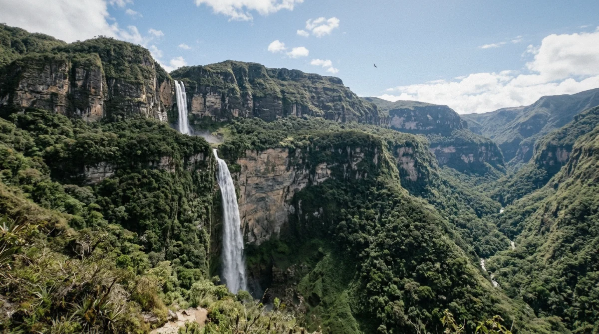
Gocta waterfall is 771 m (2,530 ft) tall in total, made of an upper tier of about 231 m and a lower tier of about 540 m, which is the tier every Gocta waterfall tour actually walks to. Whether that makes it the third-highest waterfall in the world or closer to the eighteenth depends entirely on how a database counts a two-tier drop, not on any disagreement about the tape measure.
Key takeaways
- Total height: 771 m (2,530 ft), upper tier about 231 m, lower tier about 540 m
- The figure was announced at a press conference on 11 March 2006 by German explorer Stefan Ziemendorff, who had reached the falls in 2002
- The "third highest waterfall in the world" claim is disputed. The World Waterfall Database ranks Gocta around 16th to 18th because it treats tiered falls differently
- Angel Falls (about 979 m) and Tugela Falls (about 948 m) are the two falls Gocta is most often measured against
- Yumbilla, about 896 m and roughly two hours from the same base town, is measured taller than Gocta and sees far fewer visitors. See Gocta and Kuelap for the wider region
- The 5.5 km hike to stand under the lower tier is covered in full on the Gocta hike guide
771 Metres, and How It Breaks Down
Gocta is not a single drop of water falling 771 m in one motion. It is two falls, one stacked above the other, separated by a stretch of cliff and forest where the river gathers itself before the second leap.
The two tiers
The upper tier drops about 231 m from the point where the Cocahuayco river leaves the plateau above Bongará province. It is the shorter of the two, closer to vertical, and lands in a hanging basin that most visitors only ever see from a distance, on the San Pablo side of the valley.
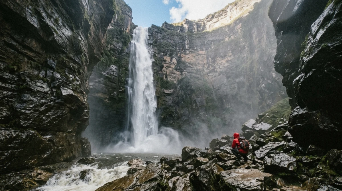
The lower tier is the one that gives Gocta its reputation: about 540 m, falling in a wide curtain into a rock amphitheatre and a cold, dark plunge pool. This is the tier that every tour operating out of Chachapoyas, including all three compared on this site's homepage, walks the visitor to. Add the two together, plus the short connecting stretch between them, and the total the surveys settled on is 771 m, or 2,530 ft.
- Upper tier: about 231 m, a near-vertical first leap
- Lower tier: about 540 m, into a rock amphitheatre and a cold pool
- Total measured height: 771 m (2,530 ft)
Why the split matters more than the total
A 771 m single drop and a 771 m fall split into 231 m and 540 m are not the same physical thing, even though both numbers are accurate. A database that only counts continuous, uninterrupted drops has to make a decision about where Gocta belongs on its list, and that decision is the entire source of the ranking dispute covered below. The height itself was never seriously in question after 2006; what was, and still is, argued over is what to do with a waterfall that has a natural pause built into it.
Why the World Ranking Is Disputed
Tour brochures still print "third highest waterfall in the world." Waterfall databases that apply consistent criteria across every fall on earth put Gocta much further down their lists. Both statements are defensible, which is exactly the problem.
How different sources rank it
The gap between the popular claim and the technical ranking comes down to classification, not measurement: every source below agrees on the 771 m figure; they disagree on whether a fall split into two tiers should be scored as one continuous waterfall or as two separate drops. Read the table this way: sources that count Gocta as one uninterrupted fall put it near the top of the world list, and sources that apply the same tiered-fall rule to every entry on their list put it much lower.
| Source | Rank given | How it counts the fall |
|---|---|---|
| 2006 press announcement | 3rd highest in the world | Counted as one continuous 771 m drop |
| Early tourism promotion, Peru | 3rd or 4th highest | Repeats the 2006 classification |
| World Waterfall Database | Around 16th to 18th | Applies consistent single-drop criteria; scores the two tiers separately |
| Some independent waterfall lists | 5th highest | Counts total height but with different comparison sets |
| Regional tourism material, Amazonas | Among the tallest in South America | Avoids a specific world rank; focuses on total height |
Reading the table honestly
None of these sources are wrong about the height. They disagree about classification: whether a distinct break between a 231 m upper tier and a 540 m lower tier disqualifies Gocta from being scored as one continuous drop the way Angel Falls is. The World Waterfall Database, which applies the same rule to every entry on its list rather than making an exception for a famous name, is generally treated as the more rigorous reference, which is why it lands Gocta around 16th to 18th rather than 3rd.
How Gocta Was Measured, and by Whom
Gocta's fame is barely two decades old, and the story of how that happened is almost as told-and-retold as the height itself.
The 2006 announcement
The German explorer Stefan Ziemendorff reached the falls with Peruvian companions in 2002, working with local guides from Cocachimba and San Pablo who had known the waterfall their entire lives. It took until 11 March 2006 for the measurement to reach a press conference and, from there, an international audience: 771 m, announced as the third-highest free-leaping waterfall in the world, behind Angel Falls in Venezuela and Tugela Falls in South Africa.
That comparison was drawn against incomplete National Geographic figures available at the time, and it has been disputed ever since; see the ranking table above. What is not disputed is the 771 m total, which has held up through every subsequent survey.
Not lost, just unpublished
Gocta was never a secret to the people who lived under it. Families in Cocachimba and San Pablo had farmed the valley for generations, and Peruvian maps of the area already existed before 2002. What changed in 2006 was not the waterfall's existence but its publication: a number, attached to a press conference, that a global audience could read.
Local legend offers its own explanation for the silence. A blonde-haired mermaid is said to guard a treasure in the plunge pool at the base of the lower tier, and villagers held that revealing the waterfall's location, or its scale, would bring a curse down on the community. Whether that story functioned as genuine belief or as a practical way of keeping something valuable quiet, the outcome was the same: no published measurement, and no tourists, until an outsider put a number on it.
One Waterfall or Two
This is the argument underneath every ranking table on this page, stated plainly.
The case for counting it as one
The water that leaves the plateau above Cocahuayco and the water that lands in the amphitheatre at the base is the same river, on the same cliff face, falling a combined 771 m with only a short break in between. Treated as one continuous natural feature, that height puts Gocta among a small handful of falls on the entire planet, and it is the basis for the 2006 podium claim.
The case for counting it as two
A database working through every waterfall on earth needs a rule that applies the same way to all of them, and the rule most of them use is that a distinct break between drops, where the water gathers or the cliff face changes angle, splits a fall into separate tiers for ranking purposes. Gocta's upper and lower tiers meet that definition: about 231 m, a gap, then about 540 m. Score them separately and the lower tier alone, at 540 m, is still an enormous single drop, but it no longer competes with 900-plus-metre falls that drop in one uninterrupted motion.
This is the classification argument in full, and it is the reason the same waterfall can honestly be described as third-highest in one sentence and eighteenth in the next. Neither number is fabricated. They are answering slightly different questions.
How It Compares to the Falls It Is Measured Against
Every ranking claim about Gocta references the same small set of famous waterfalls. Here is how the total heights actually stack up.
Height comparison
Angel Falls, in Venezuela, is the uncontested benchmark at about 979 m, the tallest uninterrupted waterfall on earth by any measure. Tugela Falls in South Africa follows at about 948 m. Gocta's 771 m sits well below both, and even Kaieteur Falls in Guyana, at about 226 m, is a completely different kind of comparison: it is not competing on total height, only on volume and drama at a single drop.
| Waterfall | Location | Total height | Counted as |
|---|---|---|---|
| Angel Falls | Venezuela | About 979 m | Single continuous drop |
| Tugela Falls | South Africa | About 948 m | Multiple tiers, counted together |
| Yumbilla Falls | Peru, same region as Gocta | About 896 m | Tiered fall |
| Gocta | Peru | 771 m (231 m + 540 m) | Two tiers, disputed classification |
| Kaieteur Falls | Guyana | About 226 m | Single drop, exceptional volume |
What the comparison actually shows
Gocta is genuinely one of the tallest waterfalls anywhere near a road, which is a fair claim even without the podium ranking. It simply is not competing at the very top of the world list once tiered falls are scored on the same terms as everything else, and the waterfall that beats it on height sits two hours down the same valley.
Yumbilla, the Taller Neighbour Nobody Visits
The single most surprising fact in the entire ranking argument is that a taller waterfall than Gocta exists in the same region, roughly two hours from the same base town, and almost nobody goes.
The numbers
Yumbilla falls is measured at about 896 m, well above Gocta's 771 m, and sits in the same general Bongará-province landscape of cloud forest and river valleys, roughly two hours from Chachapoyas by road. It sees a fraction of the visitors Gocta does, largely because its route is longer, its infrastructure is thinner, and it lacks the 2006 press-conference story that put Gocta on the map.
The day trips compared on this site's homepage do not visit Yumbilla, they run to Gocta from Cocachimba, so anyone specifically chasing the taller of the two falls needs to arrange the trip separately in Chachapoyas. For a full picture of how a Yumbilla side trip fits alongside Gocta and Kuelap in a multi-day plan, see Gocta and Kuelap.
What the Height Means on the Ground
Numbers on a page are one thing. What 771 m actually feels like at the base is another.
Standing under it
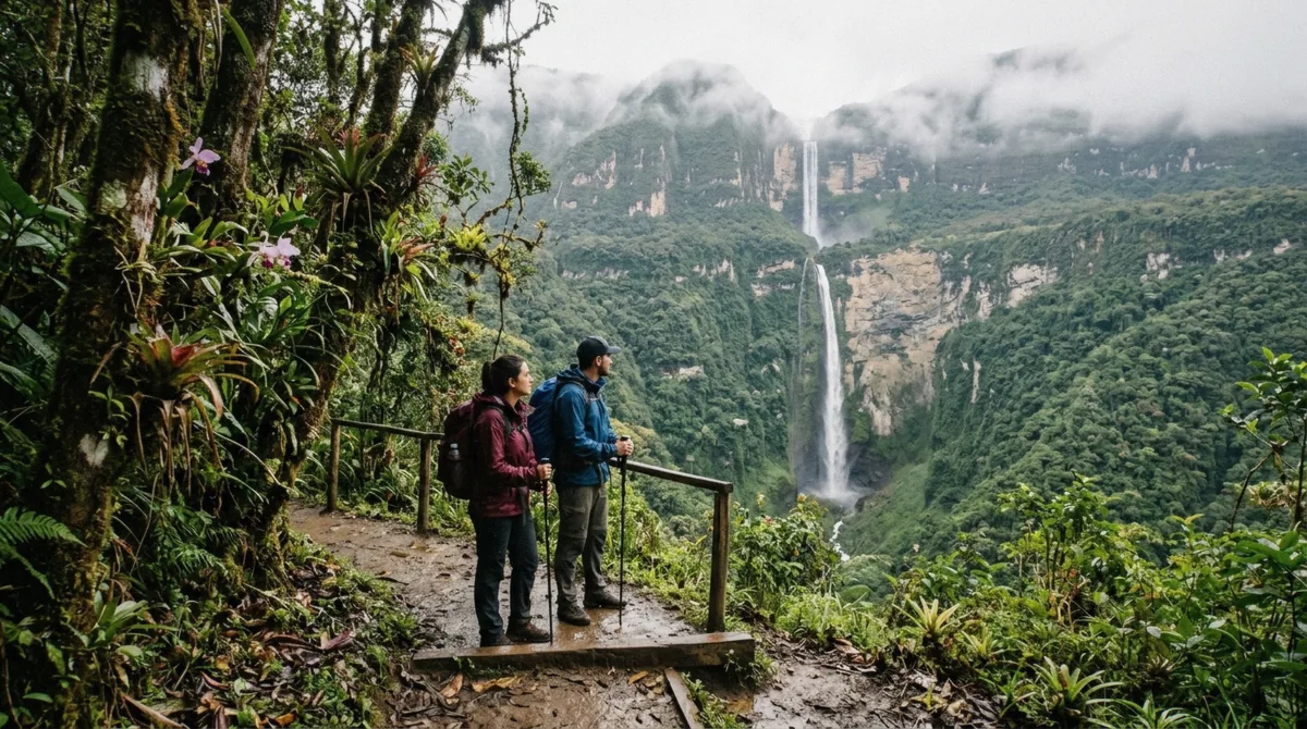
The lower tier alone is a 540 m column of falling water, and the amphitheatre it lands in concentrates the spray and downdraught enough to unbalance a person who stands upright too close to the pool, the reason visitors approach the last stretch low, over the boulders. The trail that reaches it runs about 5.5 km each way from Cocachimba, and the full physical detail of that walk, including surface conditions and elevation gain, is covered on the Gocta hike guide rather than repeated here.
Whether the 771 m figure translates into an experience worth a full day of walking, and what the honest downsides of that day are, is answered directly on the is Gocta worth it page.
None of the ranking argument changes what a visitor actually sees at the base of the lower tier: a rock amphitheatre, a 540 m wall of falling water, and cloud forest on every side. The number on the sign is 771 m either way, and the argument over whether that makes it third or eighteenth belongs to the databases, not to the walk.
Gocta Waterfall Height: Questions Travellers Ask
How tall is Gocta waterfall in total?
771 m (2,530 ft), made up of an upper tier of about 231 m and a lower tier of about 540 m. The figure was announced in 2006 and has held up through every later survey.
Is Gocta really the third-highest waterfall in the world?
Only if it is counted as one continuous 771 m drop, which is how the original 2006 announcement framed it. Databases that apply the same tiered-fall rule to every waterfall, like the World Waterfall Database, rank it around 16th to 18th instead.
Who discovered Gocta waterfall?
It was never lost to the people living under it, but the German explorer Stefan Ziemendorff reached it with Peruvian companions in 2002 and announced the 771 m measurement at a press conference on 11 March 2006, which is what brought it to international attention.
Is Gocta one waterfall or two?
Physically it is one river falling in two distinct tiers with a break between them. Whether that counts as "one waterfall" or "two" for ranking purposes is a classification choice, not a factual dispute. See the full explanation above.
Which is taller, Gocta or Yumbilla?
Yumbilla, at about 896 m, is taller than Gocta's 771 m. It sits roughly two hours from Chachapoyas, the same base town most Gocta tours leave from, and receives far fewer visitors.
How does Gocta compare to Angel Falls?
Angel Falls is about 979 m, roughly 200 m taller than Gocta's 771 m, and is the tallest uninterrupted waterfall on earth by any measure. Gocta was compared to it in the original 2006 announcement, which is where the "third highest" claim originated.
Why do some sources rank Gocta much lower than others?
Because they classify it differently. Sources that treat the 771 m as one continuous drop rank it near the top of the world list; sources that split it into a 231 m upper tier and a 540 m lower tier, and apply that rule consistently to every waterfall, rank it around 16th to 18th.